Palo Alto Township Map
From Andreas Historical Atlas of Iowa 1875
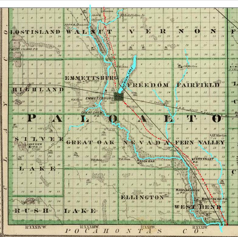
I have copied the Map to PC and enhanced it in this way: The dotted line which indicates The Old Government Road - the route the first settlers travelled - that dotted line I've colored RED dots. Medium Lake & the Des Moines R., along with smaller tributaries, I've colored Blue. --- Matt O'Dell
In Emmetsburg Twsp. Just NW of the Emmetsburg Town plat -
you will see a tiny black spot about middle of Sec No.
23. right next to the river. That dot is exactly where "The
Patch" or "The Irish Colony" was located that first
winter, and that faint road thru the middle of Sec. 23 has to be the main street
of Old Town of Emmetsburg, it is even shown as crossing the river, and there was
a river bridge constructed there about 1875. Last time I was in E'Burg
that old bridge,
hidden in the timber - tattered and torn, was still standing, I could walk
gently across the old planks. -- Matt
O'Dell